|
A son journeys to his father's
battle site
Return
to Driniumor
My trip to New Guinea
Jim McCracken's
Perilous Journey
|
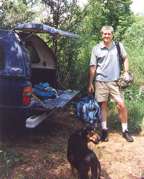
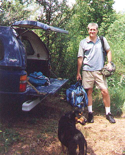
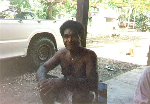
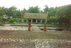
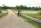
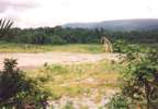
40-Jim McCracken about to be driven to the airport. Notice the
tenting I carried with me. Now that was a wasted effort! |
Click any picture for a larger view
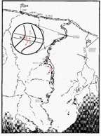
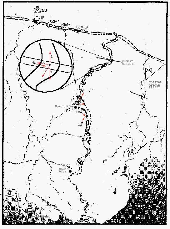
Sketch of the area. Note numbers indicating view of pictures.
If you click on the map, it will stay open for reference. |
On June 10, 1944,
on the north coast of New Guinea, the American and Japanese armies
fought a little known, month-long battle in a 5-mile stretch of
jungle between the Toricelli mountains and the Bismarck Sea, along
the Driniumor river. My father was a combatant in that fight.
In the later years of his life, he wrote enough about his experiences
there to entice me to learn about the history he had witnessed.
Toward that end, I resolved to travel to that same river, walk
the same trails and see with my own eyes. In July of 1994, 50
years to the month after the battle, I did exactly that. This
essay is an attempt to express the high points of the trip, and
to underscore some of the problems encountered by a middle class
white man used to his comforts. I used disposable cameras with
400 asa for the pictures because I was too paranoid to go there
with an expensive camera. |
I was able to find a travel agent in Austin
who could book me airplane tickets all the way to Wewak and hotel
reservations in Port Morseby. I never heard of any kind of tour
group
|
|
that could take me where
I wanted, so I just had to plunk down my money and go. The
biggest problem I had was psychological, You know, fearing
fear itself kind of thing. When you start reading about travel
to New Guinea, you start to see the country that is rather
dangerous, especially Port Moresby. When I was about to leave
the country, Clement Anawan, to be introduced later, told
me that I could very easily be killed in that town, so I stuck
close to the airport on the trip back.
|
| I arrived in Port Moresby after
26 straight hours of travel, disoriented, jet-lagged, and culture-shocked.
The airport is just a big tin-roofed shed. After you get your
bags and go through customs, you go out a door and boom! There
you are on a street thronged with humanity. There was no buffer
and no period of adjustment. I could actually see my hotel up
the road, but even at |
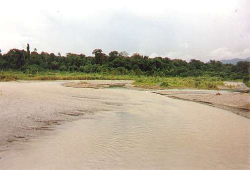
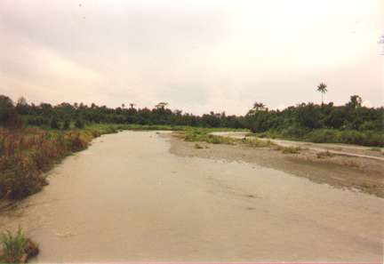
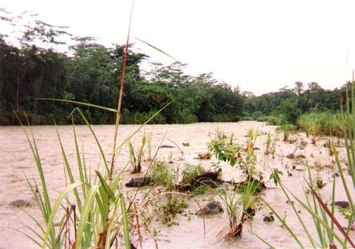
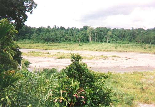
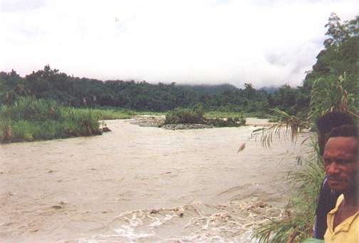
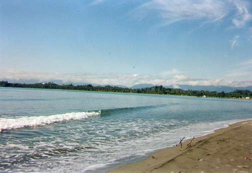
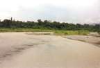
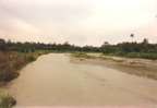
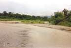
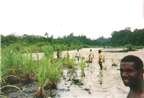
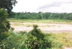
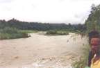
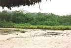
09. The Driniumor looking north from
North Afua.* |
a distance you see the concertina
wire around it and the guard at the entrance. Between the airport
and the hotel were crowds of folks just malingering in the street
in bunches in a kind
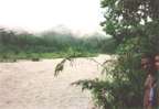
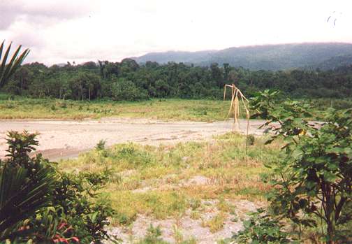
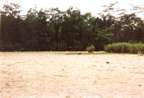
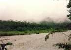
32. Looking south up river from South Afua*. You can see the
mountains through the mist. |
of party mode,
some clearly drunk, loud and killing time. I hired a cab for the
30-second drive to the hotel, and I'd do it again; although later
people told me it would have been safe to walk it if I "walked
boldly" and in the daylight. As the cab drove up the hill,
you could look back to the north and see the Owen-Stanley mountains
in the distance, and though you want to go explore it because
of the history, you really need some kind of guide who knows the
area, and more time than I had. |
| I did sleep well at the protected
hotel, and took the hotel courtesy van back down to the airport
the next day for my flight to Wewak. New Guinea is one big telephone
exchange, so you can make a local call to anywhere in the country.
I had already called the Windjammer hotel in Wewak from my room
and made reservations that morning. I caught an Air Niugini flight
and made it to Wewak by dark. They are really trying to encourage
tourism around there, and they know that they have to take the
odd tourist in hand right away or people will get hurt, so there
is a courtesy van from the Windjammer there to meet every flight.
The one other hotel in town was run by Japanese but I never saw
it. I was driven to the Windjammer where they never heard of me
or my reservation but, "yes, we have plenty of rooms available."
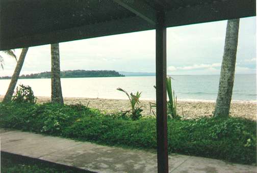
The Windjammer sits on the edge of the water and even in Wewak
they have concertina wire down to the ocean on both sides and
|
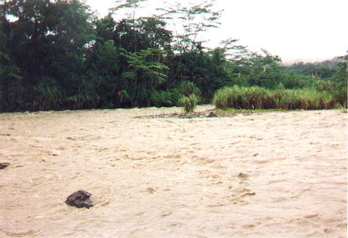
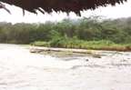
03. From the middle of the coast highway bridge, looking south
at the islands in the stream that the Japs called Kwanikajima.
It was at this spot the Japs made their initial assault on the
Driniumor line on the night of July 10. but panning a little
more towards the jungle the Japs emerged from. |
they park Doberman Pincers all along
the fence to protect the guests. But the bar is popular and I never
could go in to get me a couple of beers to drink in my room without
being collared by several of the local "old men" in there
getting sloppy drunk, pretty much an every night affair. They all
have business deals and moneymaking ideas they want you to buy into.
I did meet a fellow guest named "Cliff" from Bougainville
who said he was a chopper pilot for one of the oil companies there.
These guys are very dark and black-skinned, not brown skinned
 27 From the single go-down that now comprises
South Afua. Many Japs emerged from that jungle and somewhere
there the 2nd squadron of the 112th entered the jungle to make
its reconnaissance in force on July 10. My dad was with that
bunch.
27 From the single go-down that now comprises
South Afua. Many Japs emerged from that jungle and somewhere
there the 2nd squadron of the 112th entered the jungle to make
its reconnaissance in force on July 10. My dad was with that
bunch. |
as are African blacks, and are a handsome race
in a way that the photographs you see in National Geographic
never quite catch. They tend to have facial tattoos which
make them look wild but once they speak they are typically
quite educated. Anyway, this guy Cliff was pleasant and articulate.
Later in Aitape he pulled my fat out of the fire (more on
that to come.) One thing about the New Guinea nationals (they
do not like to be called natives) is that they have very Anglicized
first names and more oriental surnames. This takes some getting
used to. The first time you meet on a trail a 70-odd year-old
grandmother with bare breasts down to her navel, spotted tattoos
all over her face around her eyes, with her grand baby in
a sling and you say "Wha name name belong you?"
She looks up and through the three teeth she has in her entire
head she smiles and says "Barbara" -- you just shake
your head.
|
|
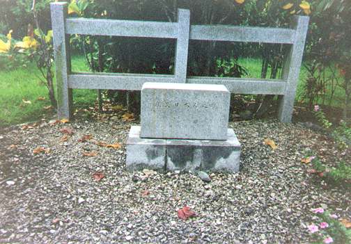
A Japanese war memorial is just across the
street from the Windjammer. It was about a half acre fenced
in. There were places with beer bottles and trash where, it
appeared people slept. On the last day I walked back one last
time and found before one of the shrines a tray with fresh Japanese
style rice cakes, a ceremonial offering. One day I rode in the
courtesy van to downtown Wewak, bought some groceries, and walked
back some two miles down the beach. The guards in front of the
Windjammer all knew me by then and were angry that I would do
such a foolish thing; they said it was lucky I didn't get pickpocketed
in town and robbed on the road back. They were upset enough
that I did not go out alone after that.
I caught a commuter flight to Aitape
the next day because the
|
35. Shrine in the Japanese war memorial in Wewak, fortunately
right across the road from the Windjammer. The entire memorial
looked forlorn and forgotten and run down, but on the last day
I was there Japanese style rice cakes on a nice tray were left
in front of this shrine. |
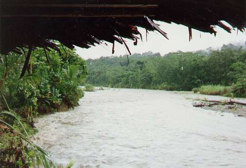
36. The main pavilion of the Japanese war memorial in Wewak.
|
highway between Aitape and Wewak
was unpaved all the way and uncertain. We flew to a small town
in the mountains named Lumi and landed, taking on and letting
off passengers. It was quite a scenic flight. On the way into
Aitape the pilot, on the intercom, announced that because of rain,
the Aitape airfield was closed and we would be landing at Tadji.
Tadji was one of the main landmarks that the battle revolved around.
We landed, and I cannot imagine the field looking any different
from what it did 50 |
years ago. The reason they can land
on it in the rain is that the Marsden Matting is still there. It was
a little rusty, but I scraped a little rust off one of the panels
and it was solid steel. It will probably still be there in a hundred
years. You see the stuff all over in people's yards and huts. They
called it "rail."
|
All there is on Tadji is
three palm fronds tri-podded to make a shelter (that's the terminal),
and a white pickup truck with two young guys and a girl about
14-years-old waiting for the airplane. The truck was missing
a starter which they had ordered from Lae but it did not make
it this trip. They agreed will give me a ride to Aitape. I helped
them push start their truck and rode in the back with one of
the guys who introduced himself as Gerald.
|
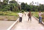
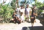
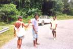 06. James, Gerald and Simon at the west
end of the coast highway bridge
06. James, Gerald and Simon at the west
end of the coast highway bridge |
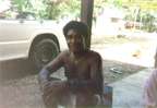
38. Clement Anawan sitting on his front porch in Aitape, with
his still starter-less pickup behind him. |
He said he would
be happy to guide me to the Driniumor, only they called it the
"Numor." Gerald is from the village of Yakamul, east
of the Numor. He was in Aitape to visit his uncle. On the way
to Aitape, it started pouring rain. They dropped me off at the
Aitape hotel soaking wet with a promise to come by later and "sort
it out." Ten minutes later I was drying off in a modern hotel
room watching Rosanne on a full color satellite TV. New Guinea
is definitely a country of contrasts. All I will say about the
Aitape hotel is that it is very nice and very expensive and the
nicest thing I can say about the fellow who ran it was that he
was a devout capitalist. |
| Gerald and his cousin
Simon came by that evening, and we had a few beers. It turned
out that Simon was my age. I never met any of these guys who knew
how old they were. They all know their date of birth, and if you
ask them their age you can see them start doing the math in their
heads. "Let's see, I was born in such and such and I guess,
(using all fingers now) I'm such and such years old." They
just don't have any reason to keep the information current. Also
most that I met spoke English pretty good but the native language
is Pidgin English which everybody talks. I kept asking questions
about how to say this and that trying to learn the talk. |
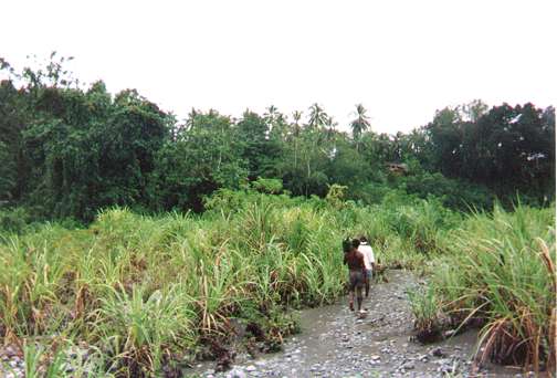
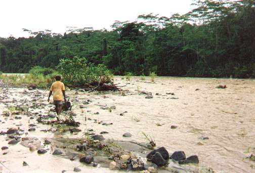
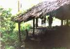
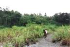
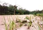
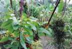
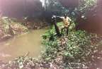
31. Albert, in front of the South Afua* go-down. Throughout
the entire hike, he was picking vegetables along the trail for
his table
|
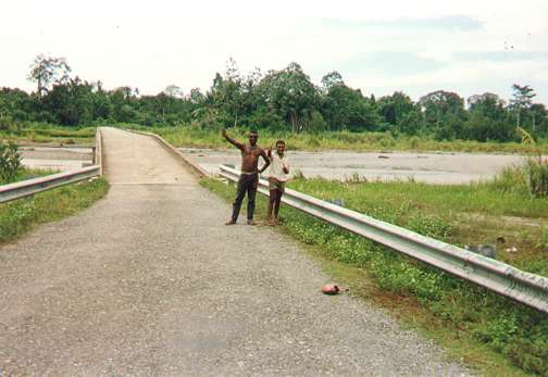
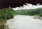
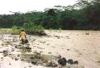
04. The coast highway bridge, from the American vantage point,
looking east across the Driniumor. The men are James and another
whose name I lost. |
I showed them all the maps of
the river and the battle I had copied from the Levenworth Paper
and the Approach to the Philippines book. They are really fascinated.
I think they knew something important happened there but they
did not know many details. Gerald said his uncle was in local
government, the Minister of Education (I think) and would I come
by the province offices tomorrow and meet him? I can't wiggle
out of that one, I figure, so in the morning Gerald comes by and
we go meet Clement Anawan, a man I will remain eternally grateful
to for making the trip to the Driniumor possible. We sat and talked
for about two hours while they taught me to chew betel nut. I
think it amazed |
them that some guy would come all
that way just to see a river. They were somewhat used to business
men traveling, but not tourists, and not alone. Clement talked a great
deal about the danger in their country, and warned me repeatedly about
watching where I went and who I fell in with. Although I did walk
around Aitape alone and unmolested, there were some white Australians
and missionaries who would drive by me and look clearly amazed to
see a white man walking alone. I figured I couldn't just hunker down
in my room and be scared, so I usually got up and out when I could.
Every national I met assumed I was a missionary till I told them otherwise.
|
We struck up a deal that I would contract
with Clement and his folks to act as my guides to the village
of Afua and up the river. They could see from the maps where
I wanted to go. When I left, I left all my information about
the river and the battle with them. They were so interested
and could not get the same data themselves. Clement agreed to
provide transportation up the coastal highway to the Paup villages.
In the morning, Gerald (who was running
the show) collected me and we walked to a section of Aitape
where Clement lived. His solution to having no starter in his
truck was to draft four or five of his sons and nephews to ride
in back and push start when required. One of his sons named
James drove since he was the
|
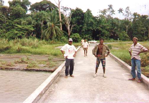
 05. The coast highway bridge, looking
west, back toward the Paup Villages. That's Clement junior in
the middle, Simon in yellow in the very back, and Clement's
white truck. Lost the names of the other folks.
05. The coast highway bridge, looking
west, back toward the Paup Villages. That's Clement junior in
the middle, Simon in yellow in the very back, and Clement's
white truck. Lost the names of the other folks. |
only one with a license. I filled
up the truck with gas and we stopped at the grocery for supplies.
Obviously, I was bankrolling the whole trip but that was expected.
I bought two bottles of water which they acted like was an extreme
extravagance but I was glad because I ended up badly needing them.
Their solution for bottled water was that every time we came to a
village, the headman would send one of the little boys up a palm tree
to cut down a couple of coconuts. They would then clip the top off
and offer it as a drink. I guess it would keep you alive, but it never
really satisfied my thirst which just built and built the whole time.
We drove east out of Aitape along the coast highway passing their
high school, the Catholic mission
|
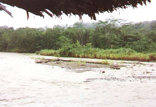
30. Shot of the go-down in South Afua*, looking out toward the
river.
|
(where I later stayed)
then turned off to Tadji, across the Nigia river on a good bridge,
(all bridges were one-lane) and through a series of villages between
the highway and the ocean. The map calls these Paup villages.
I think we had artillery and medical personnel there during the
battle. As we went through one, they pointed to a track into the
jungle that we would have to walk down to get to Afua. For now,
we would drive right up to the Driniumor. Another midl and there
it was, just like in the photos. I walked |
down to the water and put my hand
in it, just to sort of commemorate all the effort I had put out to
get there. One of the guys walked over to the rail of the bridge and
started spray painting graffiti on it. It soured my stomach but what
could I say, I was a guest in their country. I don't think he would
have done that if Clement had been there. We took pictures and tried
to explore the jungle a little but it's so thick and there are no
trails so I didn't want to go too far into it. Besides, I couldn't
hold up the truck since Clement needed it back. So we pushed it to
start it, got in and they drove us back to the intersection with the
track to Afua.
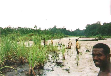
Gerald, Stephan, James and I, hopped
out for the walk inland. All the way from home I had carried this
two-man tent and some marginal camping gear. Lord knows I never needed
it. If
| any of these folks from Afua
found you camping in the jungle, they would insist that you be
a guest in their home. They would never allow you to be out in
the weather. My suitcase was the kind that broke out into a full
pack, and that was a Godsend. We didn't walk long before I saw
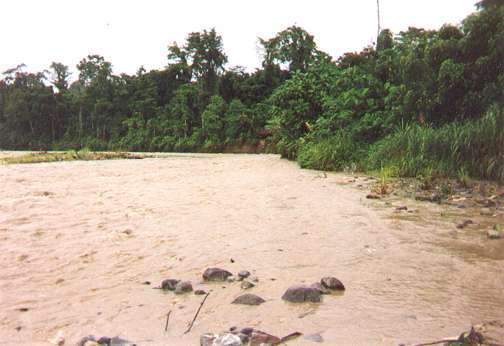
why they couldn't take the truck. Big creeks cut right across
the road that only a 4-wheel drive with a winch could navigate.
You had to take off your pack and hand it across before you could
jump. I never saw any vehicle tracks once we left the coast highway.
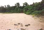
I did see some pig tracks,but in |
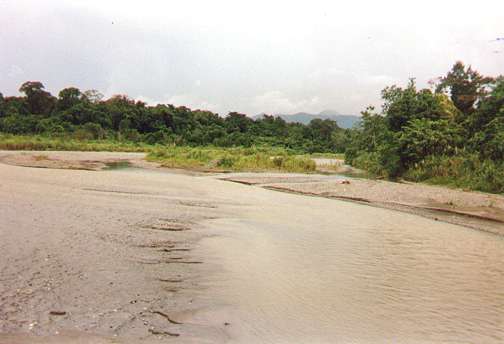
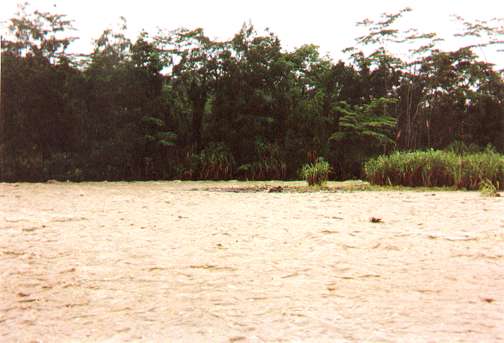
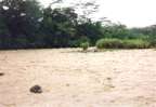
01. The Driniumor River, from the middle of the coast highway
bridge, looking north toward the Bismarck Sea |
general I was disappointed that I
never saw much wildlife as my dad had described, not as many birds
as I expected either.
After about 3 miles we walked into
the village of Afua. On the map you see the trail from Animo going
at a bit of a diagonal and not intersecting the river till about half
way to the mountains. I think that first junction of the trail and
the river is where the village is since I never saw the river till
I got into Afua. Right away I start cross referencing in my mind all
that I had read about events around the village,
| like Japanese attacks from across
the river. Right away, it just did not add up. For one thing,
the village is on a high bluff over the river (see photo 07) with
a steep 30 to 40 foot cliff going down to the stream bed. It was
a beautiful spot on the river but in no way could you assault
that position from the other side, even if no one was shooting
at you. Behind the village, on the jungle side, were big swamps
that just didn't fit the descriptions of the fighting. Later I
asked one of the old boys about it and he pointed at the village
and said "new camp" and some Pidgin that I took to mean
the old Afua was two miles up river and was destroyed in the battle.
That made sense to me; we would walk there the next day. |
07. View overlooking the Driniumor from the North Afua*, which
sits high over the river on a 30 to 40 foot high bluff. Its
right where I'd put my village if I were them. |
There was one old guy there who had
remained in the village throughout the battle while the rest of the
village stayed with relatives up in the mountains. His name was Albert,
and there were pictures of him. He and all these folks were gracious
as all get out and went out of their way to make me welcome. We had
long talks about the battle. I showed him and another guy the photo
of the natives carrying the stretcher across the river during the
battle, and they definitely knew them. My notes said that the one
just left of the one wearing the helmet was named "Spatcher."
Another was "Yakala." But seeing this picture really animated
these guys. I

08. Albert and his daughter and granddaughter in front of the
hut I slept in in North Afua.* Notice how neat they keep their
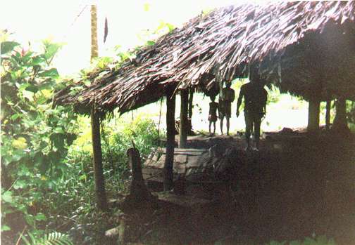
villages. That neatness was true everywhere I went. |
think it made them
feel like the US had included them in our history. At the same
time, my impression of most folks in Afua
| was that in WWII they
were rather pro Japanese. From their perspective, they were
occupied by the Japs, but it was the Americans and Australians
who |
brought true war to their homeland -- bombs and bullets and fire.
They were polite about it, but the feeling was pretty clear. On
the other hand, in the context of the post WWII cold war dichotomy,
they were every one of them totally pro American. |
They wanted to associate with the
West and there was no doubt about it. They are very serious about
their democracy; I think having a small population has that effect.
They arranged for me to stay as a guest in one of the huts for a small
fee. Everyone slept in one big room with brick and mud fireplace in
the center and the roof sides open to vent smoke. You have some sense
of privacy because you are in a mosquito net. As tired as I was, I
was the main attraction in the village that night as you are expected
to share your knowledge of your universe and the outside world. I
sat on the stoop for hours conversing with all comers, many kids.
How much did this trip cost? Do you own firearms? Do you go about
armed? Do you own pigs? Do you own a car? What about John Kennedy?
(They were fascinated with him, for some reason) Every so often, a
woman from the area would emerge out of the darkness and place some
tray of food for everybody. That night I ate sago root, wallaby, sea
prawns on some kind of greens, chicken and rice. It would have been
just plain rude to turn any of it down, so I ate plenty, and I never
once got sick in New Guinea. But I never drank un-boiled water, and
neither did I see any of the residents drink it.
 12. Two Afua residents walking north
towards the bluff that North Afua* sits on. The clear patch
in the upper right is where the village lies, and they will
mount a very steep trail up the side of the bluff to get there.
12. Two Afua residents walking north
towards the bluff that North Afua* sits on. The clear patch
in the upper right is where the village lies, and they will
mount a very steep trail up the side of the bluff to get there. |
In the morning we
drank instant coffee and bananas cooked by placing them in the
fire, peel and all, and then scraping off the burned peel. Very
interesting. It was announced that we intended to hike back up
the river that day, and everyone wanted to go. This I had no control
over, so it turned into a village pig hunt. Everyone got their
bows and arrows (they can't own guns) and started to saddle up,
laughing and joking and in a party mood. Actually all the kids
had left at daybreak for school up on the coast. All the dogs
in the village click to what's happening, and they all came. And
I do not mean dogs like these beauty contestants we raise over
here in the land of veterinarians and air conditioning. I mean
mangy, three-legged, one-eyed, toothless, |
half starved looking mutts, but
every one running around and game as hell for the hike. It just about
broke my heart that it rained in the mountains that night, and the
river was very high. This meant we couldn't go everywhere I wanted,
and we could not walk to the other side of the river. Such is life,
but I took what I could get and we started down the steep bank from
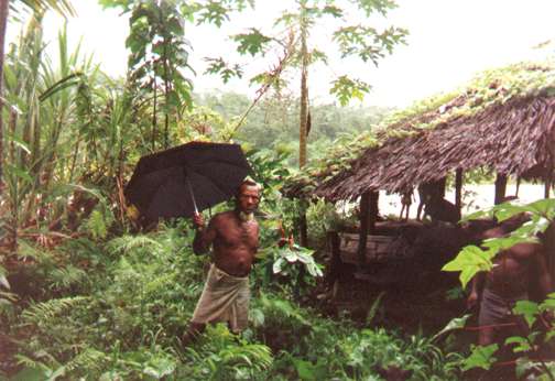
the village to the river bottom. Albert came with his umbrella and
a bemused expression on his face. All along the walk he collected
greens for his table and pointed to spots where the villagers found
dead bodies years after the battle.
| The trail winds in and out of
the jungle, sometimes skirting the river and sometimes deep in
the bush. They had to hack the trail with machetes some of the
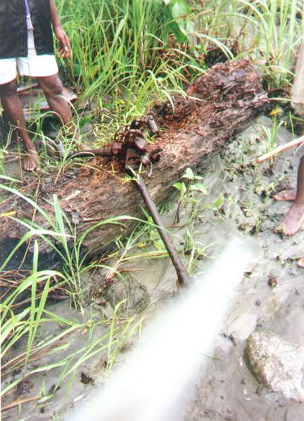
way and took turns at the point. I was not allowed to work. At
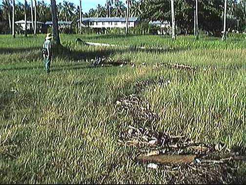
one spot in the jungle the villagers had created stacks of debris
left from the battle. One pile had five or six mortar rockets
that were unfired and unexploded. One pile of rusted metal had
four or five rusted out hand grenades, just the pineapple part,
so encrusted you could not tell if it was American or Japanese.
There was one pile of M1 clips, some with eight rounds of brass
still in them but only two retained their bullets and many with
eight rounds of encrusted brass. I tried to convey the idea that
this ordinance was dangerous as hell, but I never felt like any
of them got the message, and I was told that a lot of what I saw
was uncovered when they did a clear-burn of a section of the |
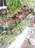
19. Not far from 16 and 17, Gerald shows the remains of a tripod
from a Jap machine gun. |
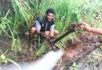
20. Not far from 16 and 17, Gerald shows the remains of a tripod
from a Jap machine gun. |
river valley for
cultivation. I emphasized the danger, and then that was all I
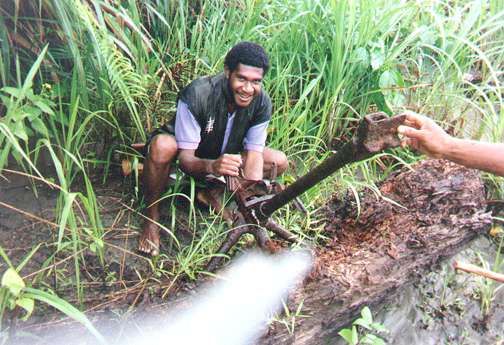
could do. I asked permission and picked up a rusted out clip from
a Japanese light machine gun to take home as a souvenir, though
the New Guinea embassy had told me when I had contacted them in
the states that it would I would not be allowed to remove artifacts.
I got the clip home though and still have it. Also there were
five or six big spools of communication wire; some with rusted
wire, some without. Albert said they had used a |
lot of it for construction, but I
was reminded by the sight what a big role communications played in
army.
I came away with several major impressions
from the walk. One was the narrowness of the area on the west (American)
side of the river, between the water and the finger of the Toricelli
mountains that paralleled it, going the entire length down from the
mountains to just north of North Afua. My dad had said that when he
fought his way into the troop C position to re-enforce them when they
were surrounded, he came down the Chinapelli trail from the river
X and when he topped a high hill behind Afua, he first heard "an
American machine gun in
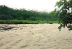
02. From the middle of the coast highway bridge, looking south
at the islands in the stream that the Japs called Kwanikajima.
It was at this spot the Japs made their initial assault on the
Driniumor line on the night of July 10. |
action." The
long finger looked to me to be a severe geographical boundary
that formed a natural arena beside the river. It is the narrowness
of that channel and the degree to which it would have forced everyone
into such a constricted zone of fighting that must be appreciated
to understand the soldier's perspective. The other thing that
stands out in my memory is the image of the hill "Sagi",
that the Americans called Hill 80. It was just such a striking
and anomalous geological feature looming up out of the river valley
and constricting the river to deep rapids at that spot. When you
see on the maps, the symbol OP on top of that hill, I assure you
it is appropriate. Albert said he witnessed an exchange of mortar
fire at night where the Japanese targeted the top of the hill
and struck it many times, but I never read that in any of the
histories. I took several photos of it, and none came out unfortunately.
|
|
I found the place where I
believed the drop zone had been, and a banana grove still there
just as described in the history books. The area is so totally
overgrown with vegetation that you couldn't make out many surface
features, but always that line of hill sides to your west when
the river was to your east. If the trees had somehow been defoliated,
you could sit on the ridge of that hill and cover the entire
drop area with a carbine, maybe even a pistol, it's that close.
Once we got back behind Sagi, where the books talk about the
"lazy S" defense, you start to realize you are looking
at the remains of foxholes. They are just depressions now but
when you start to see the pattern you realize what the "dents"
in the ground really are. I think someone with a metal detector
could have a field
|
16. From further south down the river,looking south, up river.
Really not south enough to see Where the drop zone was on your
right, or to see Sagi looming up out of the river valley. |
17. Same as 16. That's Simon with his back to us. |
day there. We walked on
to the little clearing that held a single, thatch roof godown,
which Albert said was "Afua", meaning I guess what
I now call South Afua*. This is where much of the 112th 's battle
was fought, and from here you can easily imagine the descriptions
of troop dispositions and movements in the histories. We walked
inland up the trail that leads to the river X ( these guys called
the river X the "Ringeroop") and Chinapelli.
|
| just before the "high hill"
you can start to see the outline of Troop C's perimeter from when
they were surrounded. You can see the creek on one side and follow
the ring of foxholes and gun pits through the trees in a big circle,
maybe 75 yards in diameter. The Japanese would have been shooting
down at them from the west side because of the hills, seemed like
horrible enfilade except for the trees. There were several bigger
holes in the center, probably the command section. But, since
it was totally overgrown with |
33. From the South Afua* go-down, looking directly across the
river. |
jungle, all you see are a series
of small views and you are never able to step back and see the entirety.
Most of what I describe I put together in my mind later. Even that
75-yard measurement is a total guess; it's just so hard to tell. Still
I never had any doubt that I was right where the encirclement happened.
18. Same as #17 looking north down river. The face is that of
the fellow whose hut I slept in while there. |
Actually, I could
have spent several days walking around that area; it's just that
the logistics were so stacked against anyone like me doing that.
But I had my one day, and toward afternoon the group started heading
off north toward their village. That evening passed just like
the one before. In the morning as we departed Afua, I have an
image of three village women waving at me as I walked out of sight
and yelling "apinoon, Jim!" meaning "so long."
We hiked seven hours that day, me with a full pack, north to the
coast highway and then east to Yakamul where Gerald lived and
we |
would spend the night. We stopped
at little villages by the ocean here and there and I was always unequivocally
welcomed, no hint of distrust or dislike that I could detect. On the
other hand, at one point on the road we spotted some women about 150
yards up ahead, and as we walked on towards them they ran into the
jungle in a most fearful way. I think everyone knew the guys I was
with, for sure they new Gerald, but these gals were taking no chances.
I was starting to feel complacent and this event kind of sobered me.
|
We spent the night in Yakamul,
again a small fee was charged to sleep in someone's house, again
sitting up all evening in a bull session. In the morning, we
caught a ramshackled bus back to Aitape. By now these guys were
my contacts in the area, and they got the driver to drop us
off at the Catholic mission. Here they maintain a sort of lodge
for the missionaries who come down from the mountains to rest
up in, and they gave me access for about $10 a night. The Aitape
hotel wanted $135 for the nice rooms and $85 for a cinder block
cell with a bed, and the owner had his little
|
|
tricks for "extorting" more out of
you. The Catholic mission, although shelter, was a total dump, and
I still had to sleep in my mosquito net. I think that was where
I caught the malaria I came down with some weeks after I got home,
mosquitoes just everywhere. I had airplane tickets from Wewak to
Port Moresby, and then to Carins,
| Australia. I REALLY wanted to
make those flights by this time. But Clement's family, Gerald,
Simon and others would come by and talk and drink coffee and the
next day they came by to let me know there was a problem, some
kind of bandit group was setting up roadblocks on the coast highway,
stopping and robbing folks at gun point and all civilian traffic
had ceased. I could not count on a bus ride back to Wewak. Overland
access to this area was cut off
due to a simple fact of life: the bandits had guns and the populace
did not. That is a reality I witnessed with my own eyes in a land
where firearm ownership is outlawed. |
The locals got wind of this situation
and those who had to travel would buy up all the seats on the plane
I came in on. My friends were not sure how I would get to Wewak. I
was getting so desperate that I started to yearn for a country with
strict law enforcement like Australia. But I walked into Aitape (30
minute walk from the mission) and was sitting on a bench in front
of the post office when here comes walking down the road that fellow
Cliff from Bouginville I had
| met at the Windjammer. He had
been ferrying oil company supplies into the mountains in his chopper,
and was standing down for a while, staying in the Aitape hotel
(on an expense account, I am sure). I told him my problem and
he said, "No worries, I'll fly you to Wewak in the morning
I am going down there with an empty chopper." He said, "In
the morning, when you hear me from the mission, just come out
on to the beach and I will see you and land and pick you up."
Now this had a lot of potential, but the |
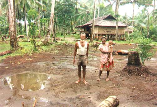
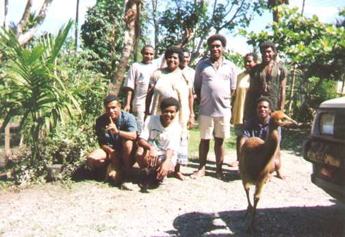
37. Clement Anawan and family, to include the Cassawory named
'Billie'. |
arrangement was just a little loose
for my comfort. Still I told him that I would certainly be on that
beach in the morning. And later in the evening, I ran into an Australian
who was staying on the first floor beneath me and he reported that
he had run into Cliff in a bar and that Cliff had told him to remind
me of his (Cliff's ) offer. So I felt he meant it, and to hell with
waiting on the beach for the sound of rotors, I got up way before
daylight, packed all my gear and humped it down the beach to the area
in front of the Aitape hotel where Cliff parked his chopper. I sat
tight and was waiting there when he walked out in the morning, and
helped him through his preflight procedures. I think it was a Bell
Long-Ranger helicopter. We finally got aboard and took off. Simon
showed up to make sure I got off, and said good by; he seemed really
concerned about me.
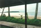
34. View from the door of my room in the WindJammer hotel in
Wewak, looking at the Peninsula known as 'Cape Wom' |
As we flew down the beach,
right outside of Aitape, some folks came out onto the beach
and Cliff landed near them and picked up a package he would
deliver, so that was a common practice with him. By that time,
I didn't care what happened as long as I wound up at the Wewak
airport in time for my flight. And I made it, followed by six
hours in the Port Moresby airport and then the plane to Carins
and a hotel reservation where they had heard of me before. I
remember sitting in my room drinking glass after glass of ice
water. Just soaking up water and the total joy of Australian
law and order.
|
*I have
taken to calling the two Afua's North Afua (where people actually
live) and South Afua, where the 112th Cav. were mainly in action.
More Photos
10. The Driniumor at the base of the bluff upon which sits North
Afua*, looking south up river. |
 11. The Driniumor looking straight across
from North Afua*.
11. The Driniumor looking straight across
from North Afua*. |
13. Looking across the Driniumor and just a little north of
where the trail breaks back out to the river. We go a little
more south and will arrive at the drop zone and the banana grove.
|
 14. Looking across the Driniumor and just
a little north of where the trail breaks back out to the river.
We go a little more south and will arrive at the drop zone and
the banana grove but panning a little more south.
14. Looking across the Driniumor and just
a little north of where the trail breaks back out to the river.
We go a little more south and will arrive at the drop zone and
the banana grove but panning a little more south. |
15. Looking across the Driniumor and just
a little north of where the trail breaks back out to the river.
We go a little more south and will arrive at the drop zone and
the banana grove but panning yet farther south. You can
see the Torricelli mountains showing through the mist in the background.
|
21. Here we are just north of Sagi, looking south up river. |
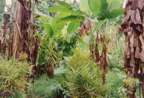
25 Banana Grove |
24 OK this is the banana grove where the drop zone was. Hard to
see more than a few feet, even when you are there. Its totally
overgrown now. I took the shots just to show how thick the vegetation
really has become. |
23. Just north of the drop zone, looking north |
28. Combine with picture #27 for a panoramic view |
26 .My dad described the drop zone as being 'between two creeks
that flowed into the river', and sure enough. This was the more
Southern of the two, back in the jungle. Again, everything is
overgrown. |
39. From the beach in Aitape, looking west towards the Toricelli
mountains |
| ................................................. |
22. From South Afua*, looking south up river. Much of the 112th's
fight happened here. |
|
* I have taken to calling the two Afua's North Afua
(where people actually live) and South Afua, where the 112th Cav. was
mainly in action.

Send Corrections, additions, and input to:
WebMaster/Editor


|